Why it's called Wineglass Bay
The prettiest name on the east coast has an ugly origin. A day down the Midlands and along the coast, with a convict bridge at each end, to a bay named, the story goes, for the colour of whale blood.
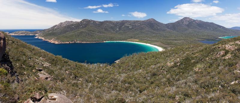
From the lookout, Wineglass Bay is a perfect curve of white sand between two green headlands. It looks like the bowl of a wineglass, and most people assume that's where the name comes from.
It probably isn't. The explanation told by the people who walk this coast for a living is darker. In the 1820s, whalers worked these waters, and when they brought a whale in and butchered it, so the story goes, the bay turned red, like wine in a glass.
That's the idea for today. Almost every name on today's map was given by someone passing through: whalers, a French mapmaker, the convicts and overseers who built the roads. The people who were here first are mostly not on it. Today's road passes them all in order.
The map
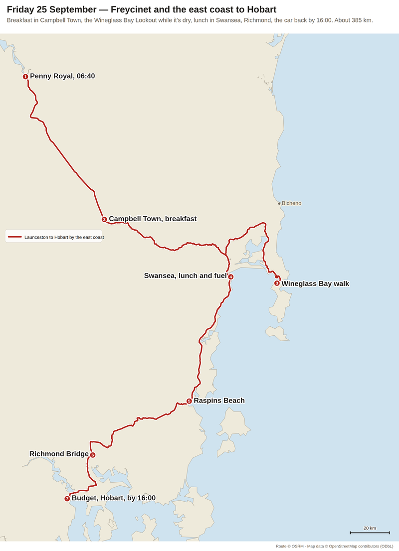
Down the Midlands, across to the coast, down it past Raspins Beach, and in through Richmond: about 385 km. Route via OSRM, map data OpenStreetMap contributors.
1. A bridge built on dry land
Breakfast is in Campbell Town, halfway between Launceston and Hobart. At the end of the main street is the Red Bridge.
Convicts built it between 1836 and 1838, from about 1.25 million handmade bricks. They built it on dry land, and when it was finished, they moved the Elizabeth River to run under it. It's the oldest surviving brick arch bridge in Australia, and the oldest bridge anywhere on the National Highway.
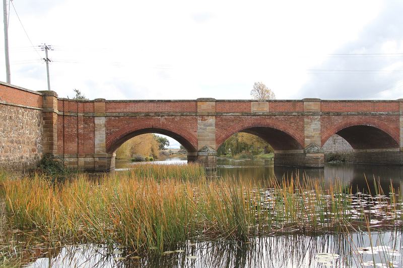
The Red Bridge, Campbell Town. Photo: Edoddridge, Wikimedia Commons, CC BY-SA 3.0.

It's a few minutes' walk from breakfast. If there's time, go down to the riverbank and look up at the arches. Every one of those bricks was made by hand.
2. Whose country
From Campbell Town the road turns east, over the hills to the coast. All of it, and the whole coast we drive down this afternoon, is the country of the Oyster Bay nation.
Parks Tasmania puts them at an estimated 600 to 700 people, in country that reached from the Derwent estuary up the east coast to the Fingal Valley, and west to the Midlands. The records suggest the Freycinet Peninsula belonged to one clan, the toorerno-maire-mener. In 1816, a sea captain, James Kelly, wrote down that he'd seen a party of Aboriginal people on Schouten Island, just off the peninsula's tip.
Their places are along the shore: shell middens, stone quarries, rock shelters, stone tools. The campground at Richardsons Beach sits beside one of the largest shell middens known on the east coast. Parks says these sites have a strong and continuing connection to the Tasmanian Aboriginal community, and asks visitors to respect them.
3. The Frenchman's peninsula
The peninsula is named after Louis de Freycinet, a young French naval officer who sailed on the Baudin expedition of 1800–1803. The expedition charted much of Australia's coast. In 1811 Freycinet published the first map to show the whole of it, before Matthew Flinders' map came out.
Look at the names on the mountains as you drive in. One of the five peaks of the Hazards is called Baudin.
4. The Hazards
The Hazards are the row of granite mountains between Coles Bay and Wineglass Bay: Mayson, Amos, Dove, Baudin and Parson, the highest of them 485 metres. The granite is pink, from a mineral in it called orthoclase.
They're said to be named after Richard Hazard, an African-American whaling captain who worked this coast. So the mountains you climb to see the bay are named after a whaler too.
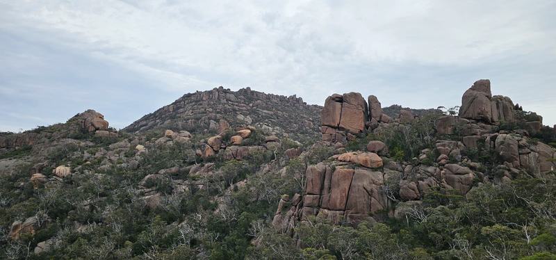
The Hazards' granite, from the track up.
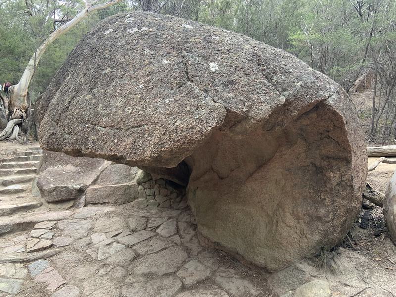
A boulder the weather has hollowed out, beside the track. Photo: my sister.
5. Why it's called Wineglass Bay
The walk to the lookout is 1.3 km each way, up the saddle between the Hazards, with a lot of steps and a few benches to rest on.
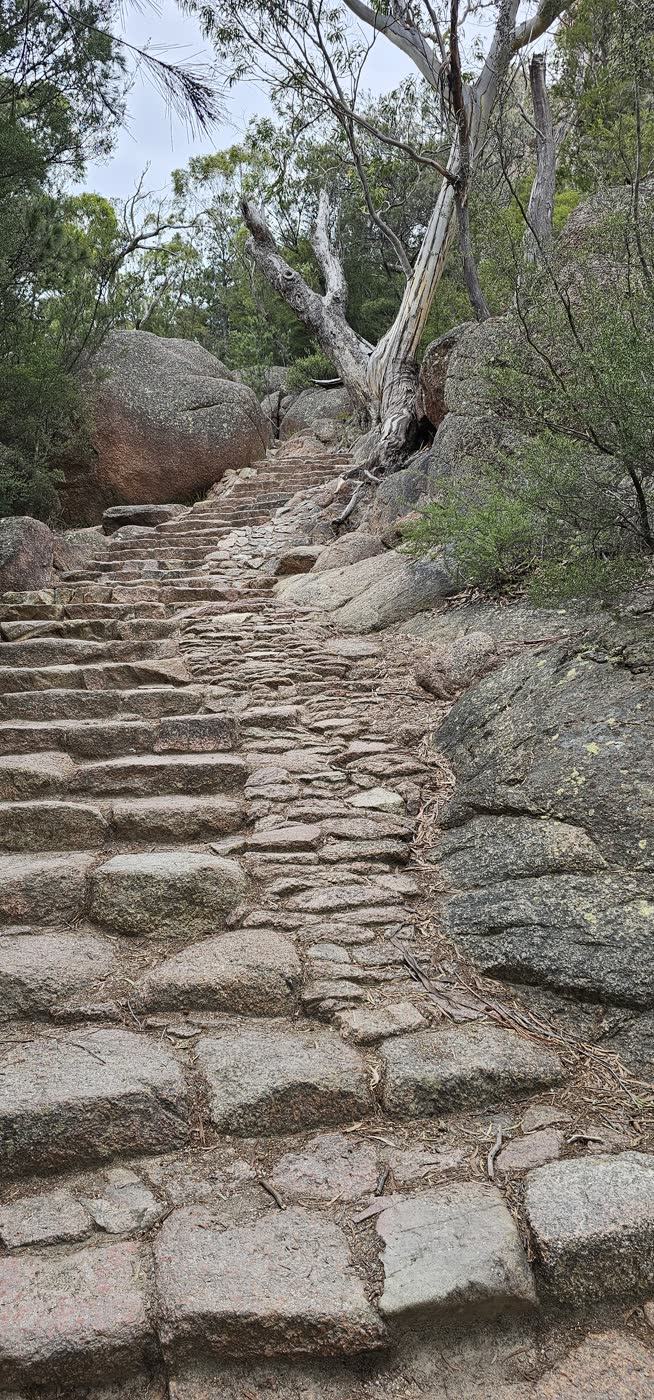
A lot of steps.
The view arrives all at once at the top.
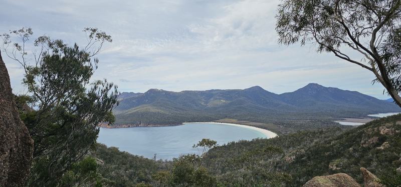
Wineglass Bay from the lookout, on our morning. Grey sky, and it still looked like this.
This year it was ranked 21st in a list of the world's 50 best beaches.
In 1824, a settler, George Meredith, set up a shore-based whaling station on the peninsula. It worked only in winter, when the whales came past, and it was abandoned by the 1850s. Whalers set out from the shore in small boats, harpooned passing whales, and towed them back to be butchered on shore.
When that happened, the story goes, the water turned red. That's the wineglass. The local walking company that tells the story puts it bluntly: the name has nothing to do with the shape you see.
Shore whaling here lasted about twenty years. The remains of the whalers' camps are still in the park.
And the whales came back. Parks says whales, humpbacks especially, now visit the peninsula regularly in the winter months, and sometimes people see them from the lookout. The bay kept the whalers' name; the whales outlasted the whalers.
6. The lighthouse at the edge
Cape Tourville is a flat boardwalk loop round an automated lighthouse, twenty minutes, right to the cliff edge in places. You can see the Hazards, Wineglass Bay, and the offshore rocks called the Nuggets. Sea-eagles, whales, seals and dolphins have all been seen from here.
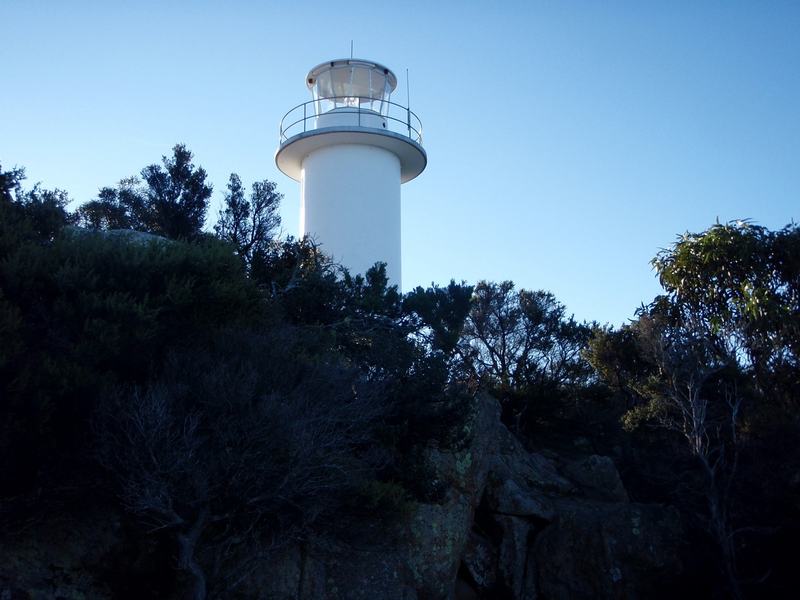
Cape Tourville lighthouse. Photo: VirtualSteve, Wikimedia Commons, CC BY-SA 3.0.

We skipped it, to be sure of getting the car back in time. Coles Bay, a town of about 500 people at the gate of the park, we only drove through.
7. The spiky bridge
Lunch was in Swansea, on Great Oyster Bay, at Artifakt Gallery & Cafe: a filled croissant with salad, a sandwich with chips, and hot drinks.
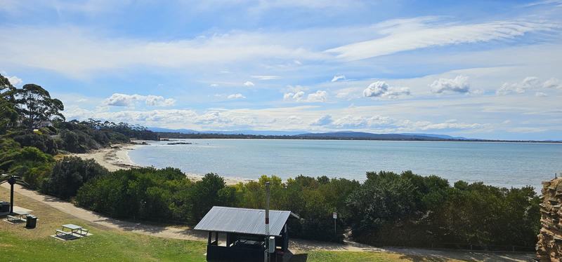
Swansea.
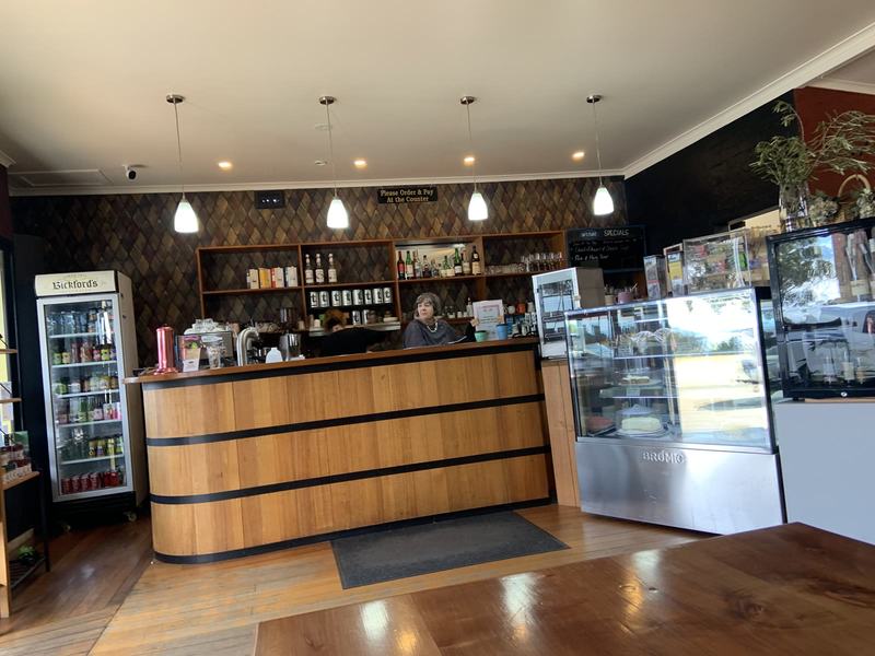
The counter at Artifakt, where you order and pay. Photo: my sister.
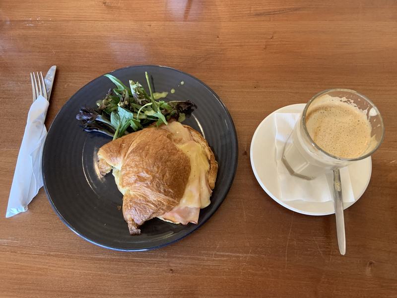
Lunch at Artifakt. Photo: my sister.
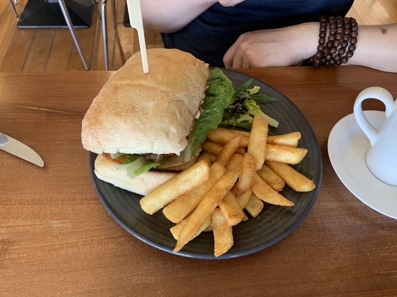
The sandwich and chips. Photo: my sister.
South of Swansea is the second convict bridge of the day. Spiky Bridge was built by convicts in the mid-1800s, 7.5 km out of town. It's made of field stones laid without mortar or cement, and the stones along the top stand on end, like teeth.
Why they stand on end, nobody we could find explains. On the hill above are the remains of the governor's cottage, looking down on the bridge.
We drove past it without stopping, so there's still no photo.
8. The long way down
Near Orford we stopped briefly at Raspins Beach, for the view across the water to Maria Island.
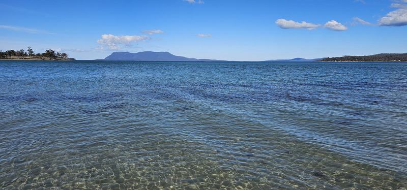
Maria Island from Raspins Beach.
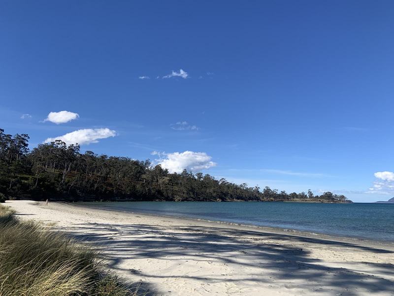
Raspins Beach. Photo: my sister.
Then, just off the road into Hobart, Richmond. Its bridge over the Coal River was begun in 1823 and finished in 1825, by convicts, with sandstone hauled to the site on hand carts. It's the oldest stone span bridge in Australia, and it's on the National Heritage List. The date stone in the middle of the parapet says 1823.
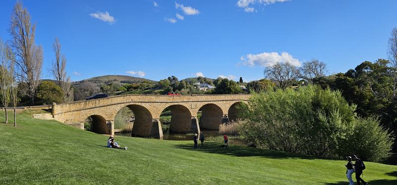
Richmond Bridge, with its 1823 date stone.
9. Handing back the keys
Then the last half hour into Hobart, and the car went back to Budget before it closed. After three days of driving, four days without a car.
From Budget it was a ten-minute walk to the YHA, our base for the next four nights.
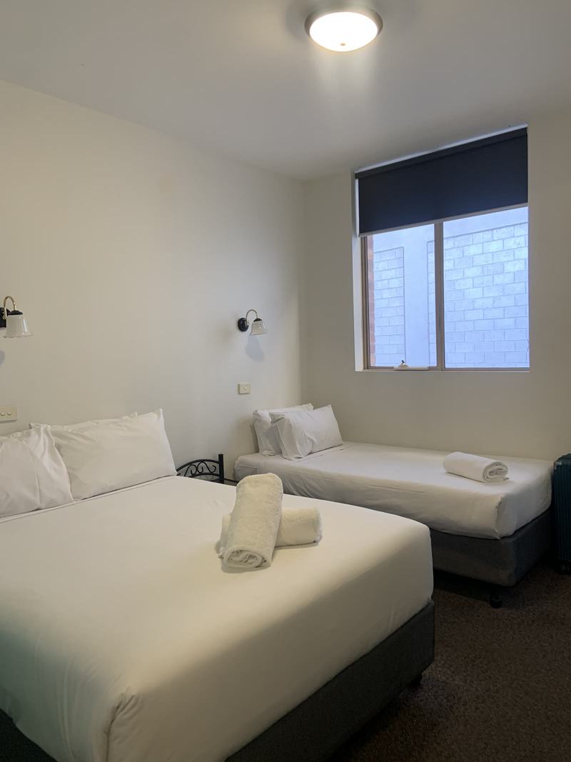
Our room at YHA Hobart Central, 9 Argyle St. Photo: my sister.
We started the morning at a bridge convicts built and moved a river for, and finished the afternoon at another: the oldest stone span bridge in the country. In between is a bay whose pretty name is a leftover from twenty winters of whaling. The water is clear again now. The name stayed red.
Look for
- The Red Bridge's arches from the riverbank in Campbell Town.
- Pink in the granite of the Hazards, especially if the sun comes out.
- Whales or dolphins in the bay from the lookout. Take your time at the top.
- Maria Island across the water from Raspins Beach.
- Shell middens along the shore. Leave the shells where they are.
- The stones on end along Spiky Bridge, and the ruin on the hill above it.
- The 1823 date stone in the middle of Richmond Bridge.
The short version
- 06:40 — Leave Launceston, through Campbell Town
- 09:30 — The Wineglass Bay Lookout walk
- Midday — Lunch at Artifakt, Swansea
- 14:15 — Raspins Beach and Maria Island
- 15:08 — Richmond Bridge
- Afternoon — The car back in Hobart
Sources: Parks Tasmania (Freycinet National Park, Wineglass Bay Lookout, Cape Tourville); Freycinet Experience Walk, "Where Wineglass Bay gets its name"; Discover Tasmania (Wineglass Bay, Spiky Bridge); Wikipedia (Red Bridge, Richmond Bridge, the Hazards, Coles Bay, Louis de Freycinet).