A mountain with four names
Skiddaw, Table Mountain, Mount Wellington, kunanyi. Every name tells you who was looking. The mountain above Hobart has kept all four, makes the city's weather, and still starts arguments.
Wherever you stand in Hobart, the mountain is there, 1,271 metres straight up behind the city. It has had four names, and each one tells you who was looking at it.
Today we go up it by bus, from the waterfront to the summit, and meet all four.
A warning for visitors to Hobart: back in town that afternoon, a group of teenagers threw lollies at us. Details and advice near the end of this post.
The map
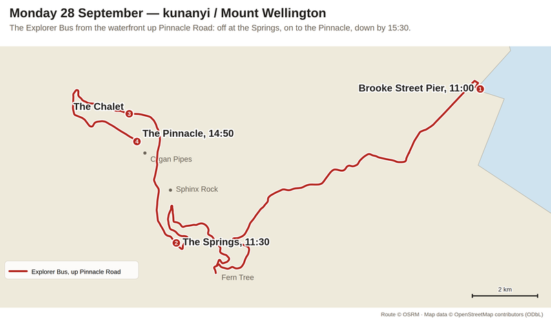
Brooke Street Pier to the Pinnacle by Pinnacle Road, about 21 km. Route via OSRM, map data OpenStreetMap contributors.
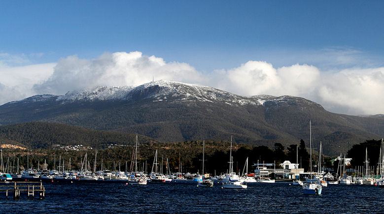
The mountain from Lindisfarne, across the river. Photo: tubagooba, Wikimedia Commons, CC BY 2.0.

1. Skiddaw, then Table Mountain
The first European names came from ships. In 1793 John Hayes called it Skiddaw, after a mountain in England. In 1798 Matthew Flinders called it Table Mountain.
You've met Flinders already. On Thursday, up the Tamar, he was the man in the Norfolk who proved Tasmania was an island. That voyage, in 1798–99, most likely brought him here too.
Both names are sailors' names: what the mountain looked like from the water, and what it reminded them of back home.
2. Wellington
In 1832 it was renamed Mount Wellington, in honour of the Duke of Wellington, who had beaten Napoleon at Waterloo in 1815.
On Saturday we walked through Salamanca Place, named after his victory at Salamanca in 1812. So the waterfront and the mountain above it both carry the same man's battles. He never came to Tasmania.
3. kunanyi
Long before any ship, the mountain had a name in the language of the people who lived below it. In palawa kani, the Tasmanian Aboriginal language, it is kunanyi.
In 2013 the Tasmanian Government brought in a dual naming policy, and kunanyi / Mount Wellington was one of the first places to get two official names. You'll see both names on the signs and on the side of the bus.
4. What Darwin saw
In February 1836, a young Charles Darwin, visiting on the Beagle, climbed it. He wrote about the tree ferns on the way up, and that "the summit of the mountain is broad and flat, and is composed of huge angular masses of naked greenstone."
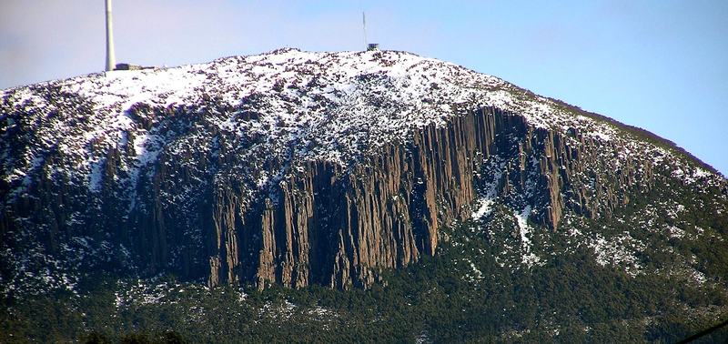
The Organ Pipes, dusted with snow. Photo: Graeme Bartlett, Wikimedia Commons, CC BY-SA 3.0.

His "greenstone" is dolerite, the rock that caps the mountain. Below the summit it has set into tall columns, the Organ Pipes, about 120 metres high. The bus company calls the walk beneath them one of Tasmania's great short walks. From Sphinx Rock, near the Springs, you can see them from below.
5. The road the unemployed built
Pinnacle Road, the road the bus climbs, was built in the early 1930s as a relief scheme for the unemployed during the Depression. It opened on 23 January 1937, after two years of work.
Halfway up is the Springs, at 720 metres. A grand hotel once stood on the flat grassy banks there. The bushfires of 1967 burnt it down, with the early huts on the mountain. Now there's a picnic ground, a café, and forest walks.
6. The mountain's own weather
At the top, the Pinnacle, the wind has been measured at sustained speeds of more than 157 km/h. Snow is common from May to October, and it can snow up there while it's mild in town: this week the forecast had snow above 600 metres while Hobart sat at 13 °C. That's why this visit moved from Saturday to Monday.
7. What they argue about now
A company proposed a cable car to the summit. On 27 July 2022, the Hobart City Council rejected the plan. The appeals tribunal upheld the decision that November.
It's the same argument as the names, really: who the mountain is for, and what it should be called when you're standing on it.
8. How the day went
Before the bus, my sister walked the waterfront on her own: Kings Pier Marina, Constitution Dock, and the Mawson's Huts replica.
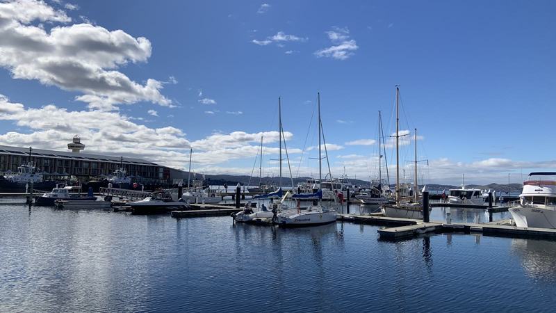
Yachts in Kings Pier Marina. Behind them, the MACq 01 hotel, built in 2017 where Macquarie Wharf Shed No. 1 stood, and TasPorts' Port Tower (1987). Photo: my sister.
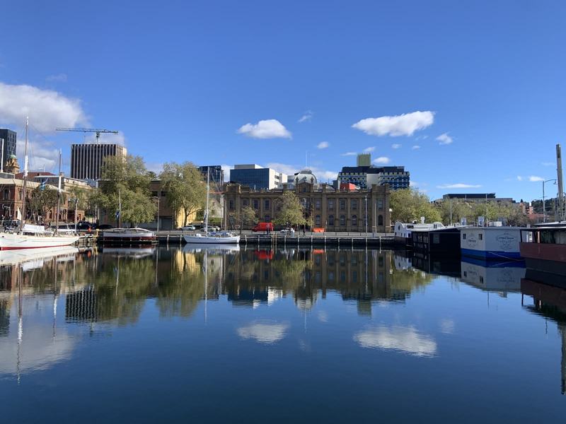
Still water in Constitution Dock, looking across Davey St to the 1902 Custom House, now part of TMAG. Photo: my sister.
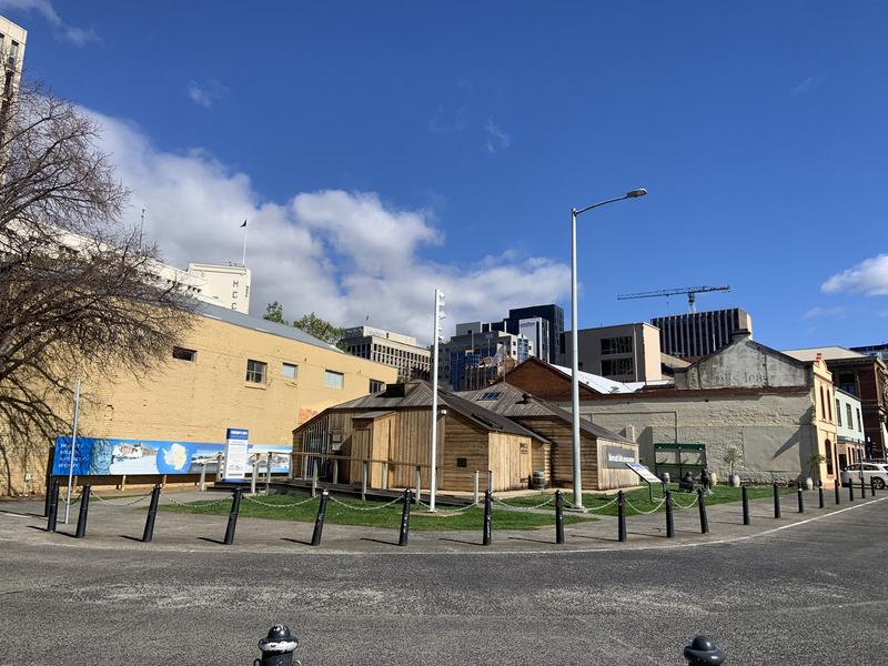
The Mawson's Huts Replica Museum, from across the road. Photo: my sister.
We took the 11:00 bus up. At Fern Tree, through the window, was St Raphael's, a little weatherboard church.
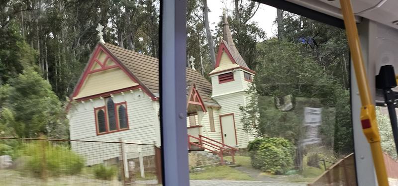
St Raphael's Anglican Church, Fern Tree, through the bus window. Built in 1892–93, it came through the bushfires of both 1898 and 1967.
Near the top the road runs beside boulder fields and snow gums, with Hobart far below.
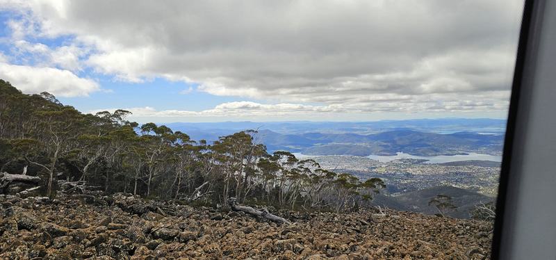
Dolerite boulder fields and snow gums near the top, through the bus window. Geologists call them periglacial: shaped by the cold of the ice ages.
We spent half an hour on the summit. There was still snow between the rocks, enough to pick up a handful of ice, and the cloud came and went over the Derwent.
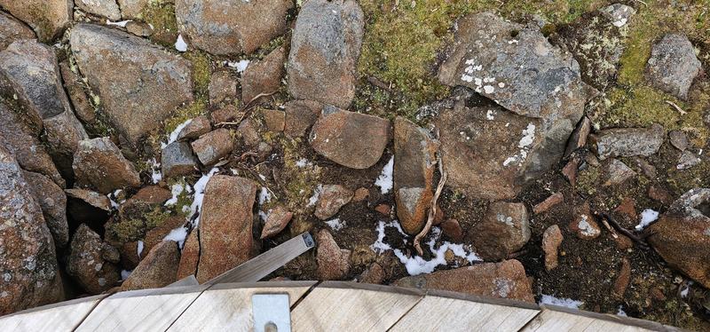
Snow still lying between the rocks beside the boardwalk.
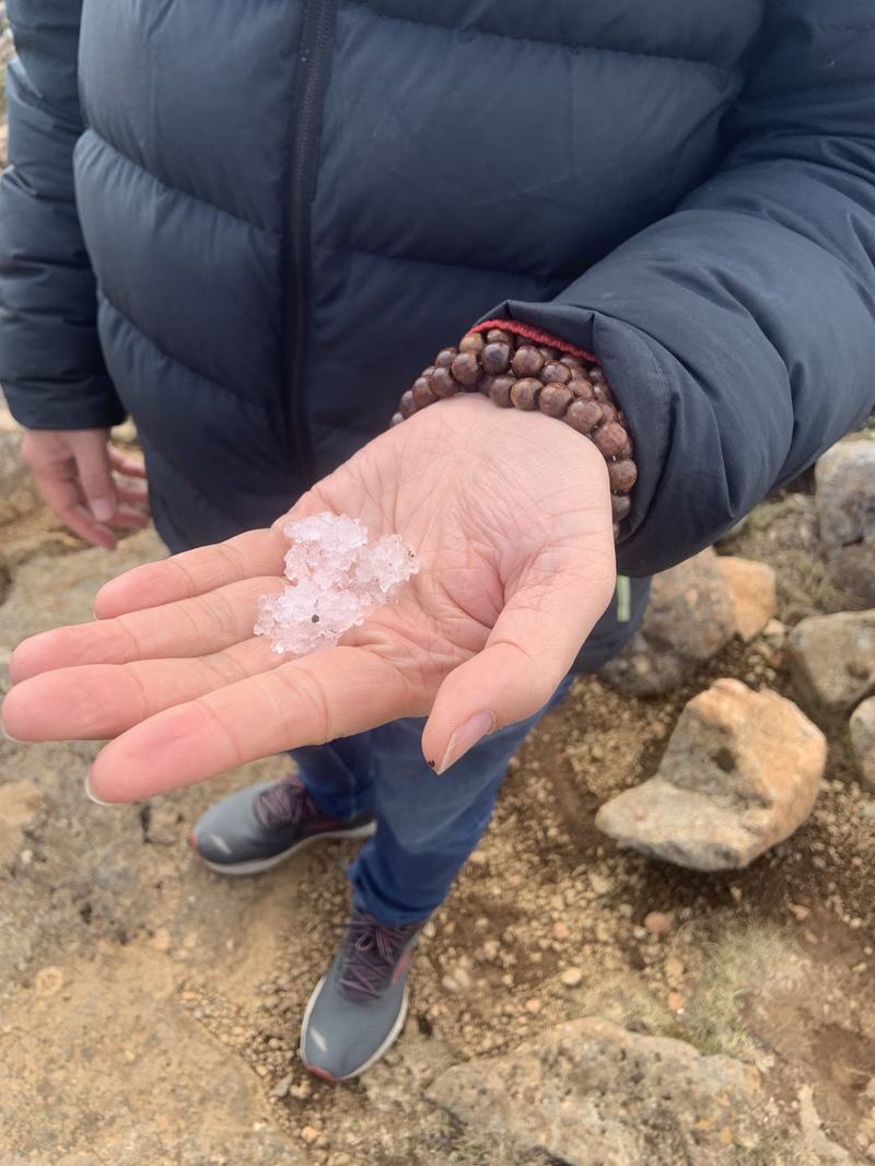
A handful of ice from the summit, at the end of September.
Around the summit, dolerite tors stand above the boulders, and a broadcast tower rises from the plateau.
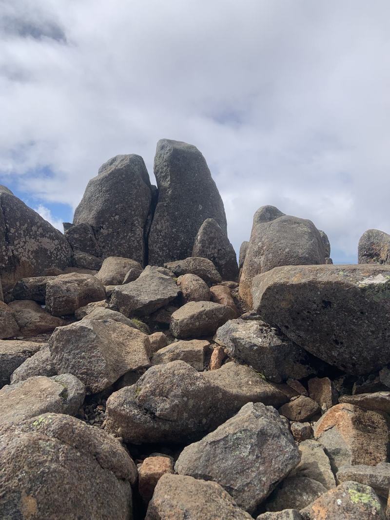
Dolerite tors at the Pinnacle. Photo: my sister.
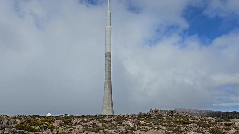
The broadcast tower, then the rocky plateau. (6-second video.)
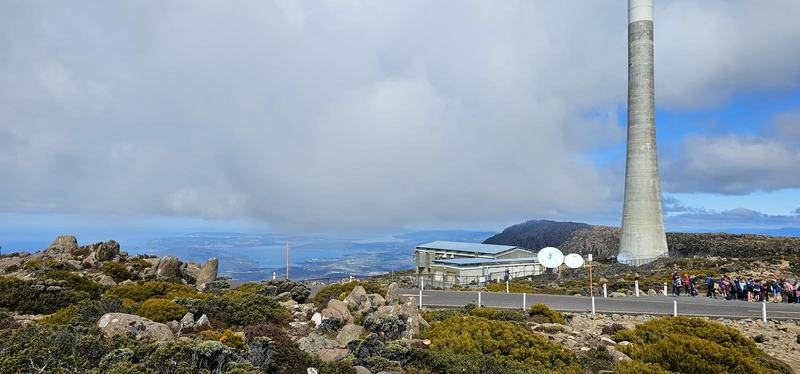
The Broadcast Australia tower, about 130 m of concrete built in 1994–95, carries Hobart's FM radio and ABC and SBS television. A school group by the road.
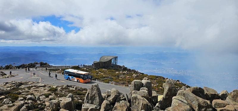
Our bus at the Pinnacle, the Pinnacle Observation Shelter (1988) behind.
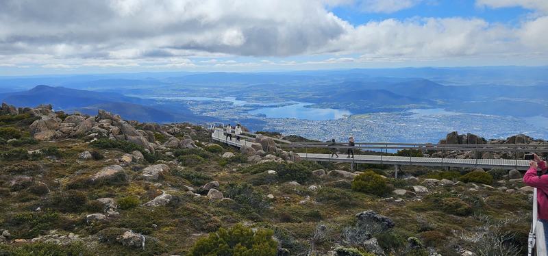
The boardwalk at the Pinnacle, the Derwent below.
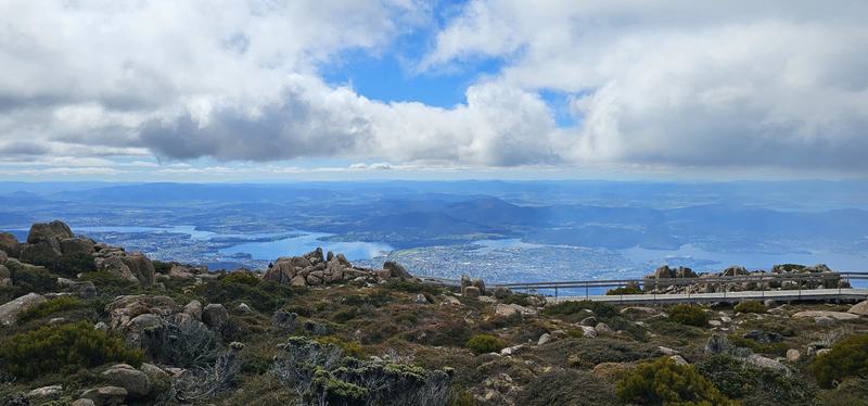
The Derwent from the Pinnacle, cloud coming and going.
Then, instead of riding all the way down, we got off at the Chalet and walked down to the Springs: the Organ Pipes Track, then the Pinnacle Track, 4.1 km.
That walk made the whole tour. The weather was fair and mild, and for an hour and a half we were wrapped in the mountain itself: birds, springs, trees, and every so often a view out over Hobart. Of everything on the mountain, that's the part I'd tell you not to miss.
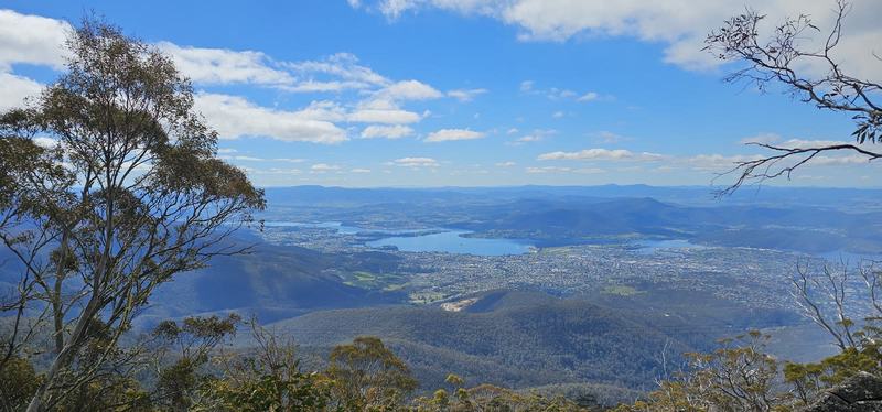
Hobart and the Derwent through the gums, early in the walk.
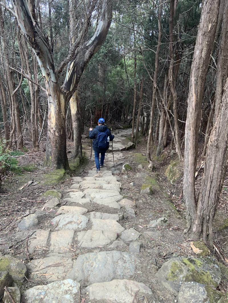
The old stone-paved track on the way down.
Near the end of the walk there's a stone picnic shelter with a gas barbecue.
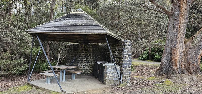
A stone picnic shelter near the end of the walk.
A warning
The day ended badly. Back in town, a group of teenagers threw lollies at my sister and me, twice, including outside the Centrepoint shopping centre on Murray Street (70 Murray St) at about 4:45 pm. We walked up to the Tasmanian Travel and Information Centre and reported it. Nobody was hurt, but it spoilt the mood of a great day.
If you're visiting:
- Try not to walk around alone, and be alert near groups of teenagers, especially in the late afternoon around the Murray Street shops.
- To report something that isn't an emergency, call Tasmania Police on 131 444. In an emergency, 000.
More from the day
Dinner was at Pot Sticker Dumpling House on Collins St: vegetable fried noodles, garlic prawns with broccoli, and vegetable fried rice.

Dinner at Pot Sticker Dumpling House, Collins St: vegetable fried noodles, garlic prawns, vegetable fried rice. Photo: my sister.
The idea, again
Sailors named it for what it looked like, the colony named it for a war hero, and the people who were here first had a name for it all along. Since 2013, the signs carry both. The mountain has kept its snow, its wind and its dolerite through every name.
Look for
- Both names on the signs and on the side of the bus.
- St Raphael's at Fern Tree on the way up: a little weatherboard church from 1892 that came through the bushfires of 1898 and 1967.
- The Organ Pipes from the bus window above the Springs, from Sphinx Rock, and close up from the Organ Pipes Track.
- Tree ferns at the Springs, like the ones Darwin noticed.
- The Derwent and the Tasman Bridge from the Pinnacle.
- Snow on the summit rocks, even if it's mild in town.
The short version
How we'd do it again:
- 11:00 — The Explorer Bus from Brooke Street Pier
- 11:50 — The Pinnacle, 1,271 m. Half an hour is enough; dress for winter
- 12:30 — The bus back down, as far as the Chalet
- 12:40 — Walk down to the Springs: the Organ Pipes Track, then the Pinnacle Track, 4.1 km. Allow 1½–2 hours
- 14:20 or 15:50 — A bus from the Springs back to town
Sources: Wikipedia (Mount Wellington, Tasmania); kunanyi/Mt Wellington Explorer (stops, walks, the Springs and the Organ Pipes); Greater Hobart Trails (the Chalet to the Springs, 4.1 km); All Saints South Hobart and Churches of Tasmania (St Raphael's); Wellington Park Management Trust (the Pinnacle Observation Shelter).