Tin, tree ferns and the Chinese of Weldborough (alternative version)
Alternative version, if you have energy. A bay named for fires that belonged to the people already living there, a waterfall named by an Irish exile, a Chinese temple that moved to Launceston, and a dam that broke on the night of the great flood. One loop of road through the north-east.
Alternative version, if you have energy. This was the plan for Thursday: six hours of driving through the north-east. At 7:15 that morning we were too tired for it and went up the Tamar instead. It's kept here for anyone with more energy, or a spare day.
The north-east of Tasmania looks like farmland and forest, and then coast. It is really a place people came to from somewhere else — for tin, mostly — and left things behind when they went.
Today's road goes past them in order.
The map
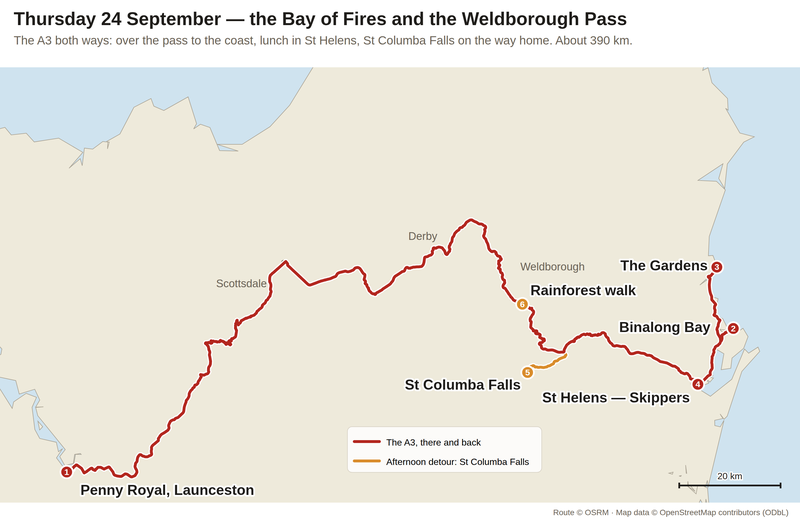
The Tasman Highway over the Weldborough Pass, there and back, with an afternoon detour to St Columba Falls — about 390 km. Route via OSRM, map data OpenStreetMap contributors.
1. The same road twice
The Tasman Highway is the big road from Launceston to the coast, over the Weldborough Pass. We drive it both ways.
In the morning we go straight through, to get to the beach. In the afternoon we come back slowly, and the stops are in the forest: a waterfall, a rainforest walk, and two tin towns.
2. Whose fires
In 1773, Captain Tobias Furneaux, sailing the Adventure on Cook's second voyage, passed this coast and saw fires all along the shore. He called it the Bay of Fires.
What he saw were the fires of the palawa people who lived here, as they had for tens of thousands of years. In palawa kani, the bay is larapuna.
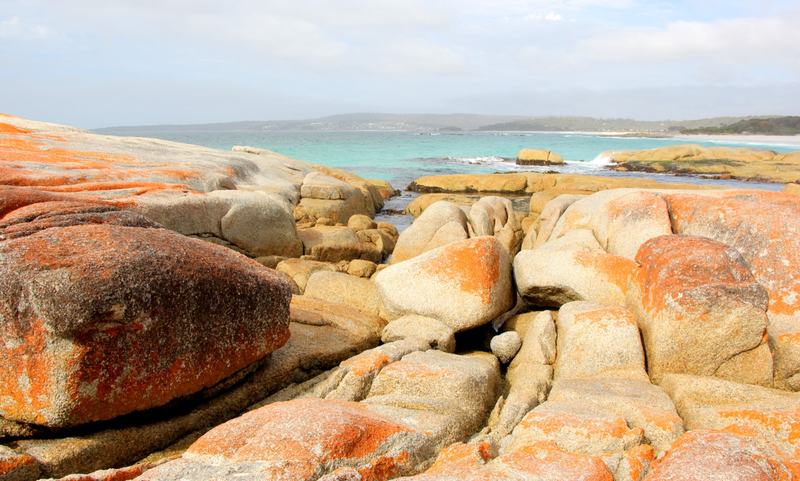
The orange is lichen. Photo: Ayanadak123, Wikimedia Commons, CC BY-SA 4.0.

Most visitors assume the name comes from the rocks. The granite boulders at Binalong Bay are covered in bright orange lichen and look like embers against the white sand. It's a good guess, and it's wrong — the name is Furneaux's, from 1773, and it's about people. But standing on the point, you can see why the rocks get the credit.
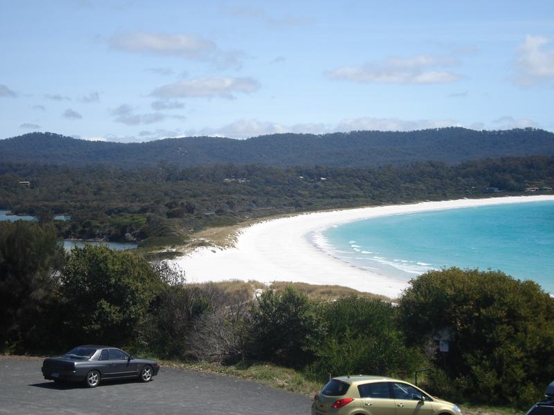
Binalong Bay. Photo: Aaroncrick, Wikimedia Commons, CC BY-SA 3.0.

Further north, The Gardens was named by Lady Jane Franklin, the wife of Governor John Franklin, who spent time in the region. Watch the water there: Parks says pods of dolphins are often seen close to shore.
3. St Helens: whales, then tin, then fish
St Helens, on Georges Bay, started as a whaling base. When tin was found inland in the 1870s it became the port that shipped it. Now it's the largest town on the north-east coast and calls itself the game-fishing capital of Tasmania.
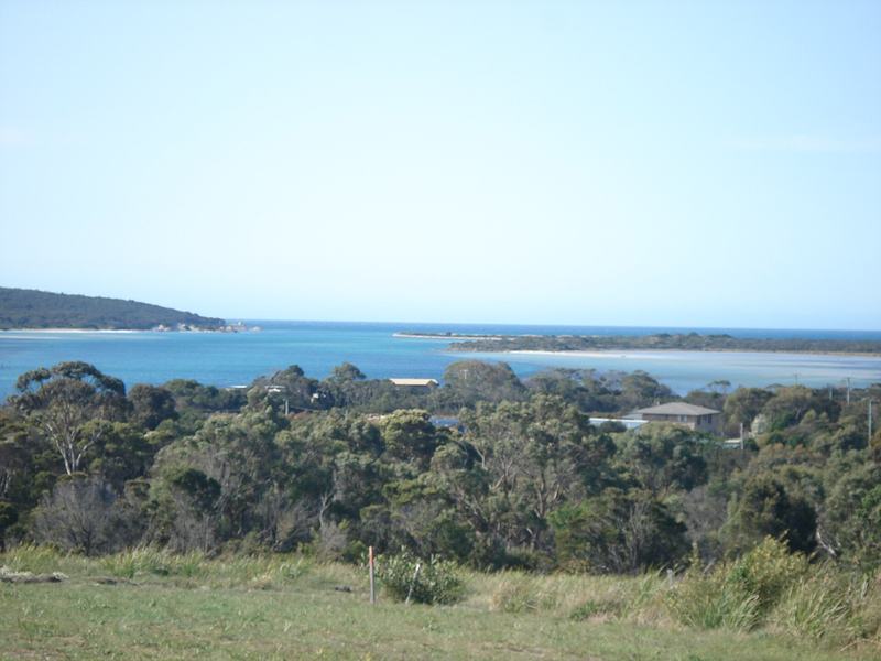
Georges Bay. Photo: Aaroncrick, Wikimedia Commons, CC0.

So lunch is from a boat. Skippers fries fish on a boat moored at the waterline. Take it to the foreshore and eat it looking at the bay the tin went out through.
4. An Irish saint in the tree ferns
Half an hour inland, George and Margaret Cotton began farming the valley of the South George River in 1875. They called their property St Columba, after the banished Irish saint. Their children found a waterfall on the family land, and their mother, an Irish exile herself, dedicated it to the same saint.
The falls have never been known to run dry. The walk down to their foot and back takes twenty to thirty minutes, through a forest of giant tree ferns, sassafras and myrtle.
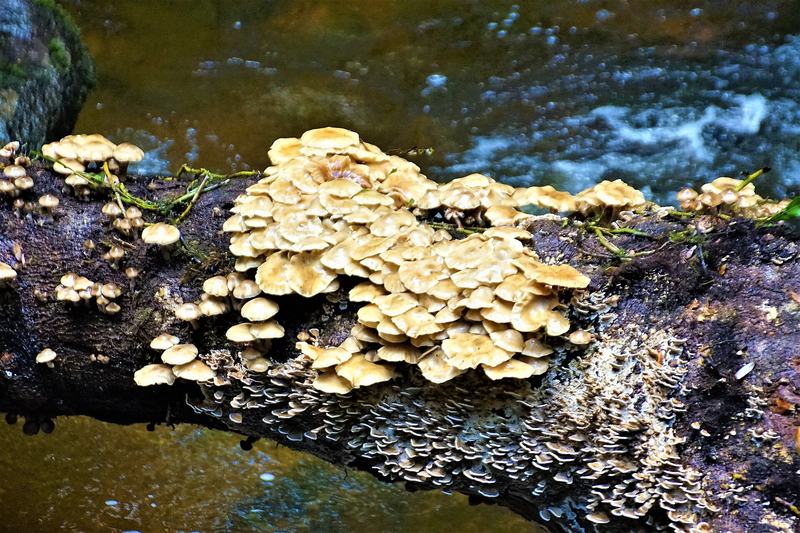
Fungi on a fallen log over the creek, from a photo titled "St Columba Waterfall". Photo: Dan arndt, Wikimedia Commons, CC BY-SA 4.0.

The tin is here too. Just off the road to the falls, an intake bridge marks the start of a water race: a 45-kilometre channel that carried water from this valley to the tin mine near St Helens.
The valley's name, Pyengana, is an Aboriginal word meaning earth or ground. Now it's dairy country, and the cheddar at the farm gate is made from the milk of a single herd.
5. Grandma Myrtle
Near the top of the pass there's a small car park that most people drive straight past. From it, a level loop of about fifteen minutes goes through cool temperate rainforest: myrtle beech and tree ferns, with smaller ferns growing on both.
Twelve signs along the way tell the history of the Earth through a character called Grandma Myrtle. Look for the myrtles growing up the trunks of the tree ferns. Usually one or the other ends up growing sideways.
6. The Chinese of Weldborough
The road climbs over the Weldborough Pass, and near the top is Weldborough: a hotel and a few houses now.
By the 1880s it was a tin-mining village populated largely by Chinese miners, who had come across from Victoria. A newspaper visitor counted "fully 300 men congregated within the camp". There were festivals, a school, and a joss house — a Chinese temple — reported new in 1884 and still in use in the 1930s.
The miners left when the tin gave out. The temple didn't vanish: its contents, with pieces from other north-east temples, are now assembled as the Chinese temple in the Queen Victoria Museum in Launceston.
You've already been past it. On Tuesday you had lunch on the corner of Brisbane Street, under a signpost pointing to QVMAG. That's where Weldborough's temple went.
No photo of Weldborough turned up that's free to use. Take one at the top of the pass.
7. Derby, 4 April 1929
On Tuesday you crossed the Alexandra Suspension Bridge over Cataract Gorge, and read that the 1929 flood took the first one away.
The same flood is here.
Derby was a tin town built around the world-renowned Briseis mine. The mine held back its water with a dam on the Cascade River above the town. On 4 April 1929, after days of rain, the dam collapsed and the water went through Derby. Fourteen people died. The mine reopened, never recovered, and shut for good in 1948.
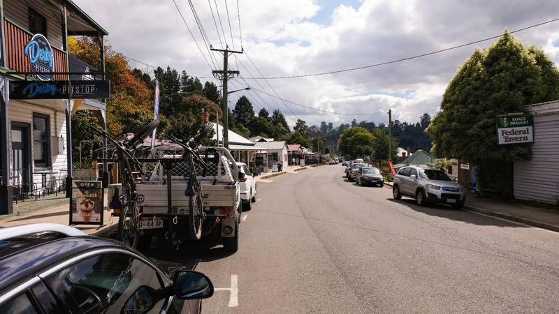
Derby now. Photo: jacobharrisau, Wikimedia Commons, CC0.

Look at what's on the back of that ute. Derby has reinvented itself as a mountain-bike town, on trails through the forest around it. You'll drive through in about a minute.
Look for
- The orange boulders at the southern point of Binalong Bay, against the white sand.
- Fire. Not really. But look along the beach and imagine what Furneaux saw from the deck.
- Dolphins off The Gardens.
- Platypus on the creek banks at St Columba Falls. They're shy; look quietly.
- Myrtles climbing tree ferns on the rainforest walk.
- The sign at Weldborough. It's easy to miss the whole village at 80 km/h.
- The mountain bikes on every second car in Derby.
The short version
- 07:00 — Out on the A3, over the Weldborough Pass
- 09:30 — Binalong Bay — the orange rocks, an hour and a half
- 11:20 — The Gardens
- 12:25 — St Helens — Skippers, lunch on the foreshore
- 13:30 — Pyengana cheddar, then St Columba Falls
- 15:25 — The rainforest walk at the top of the pass
- 15:45 — Home through Weldborough and Derby
- 17:25 — Launceston, before dusk